Mapping a Superpower
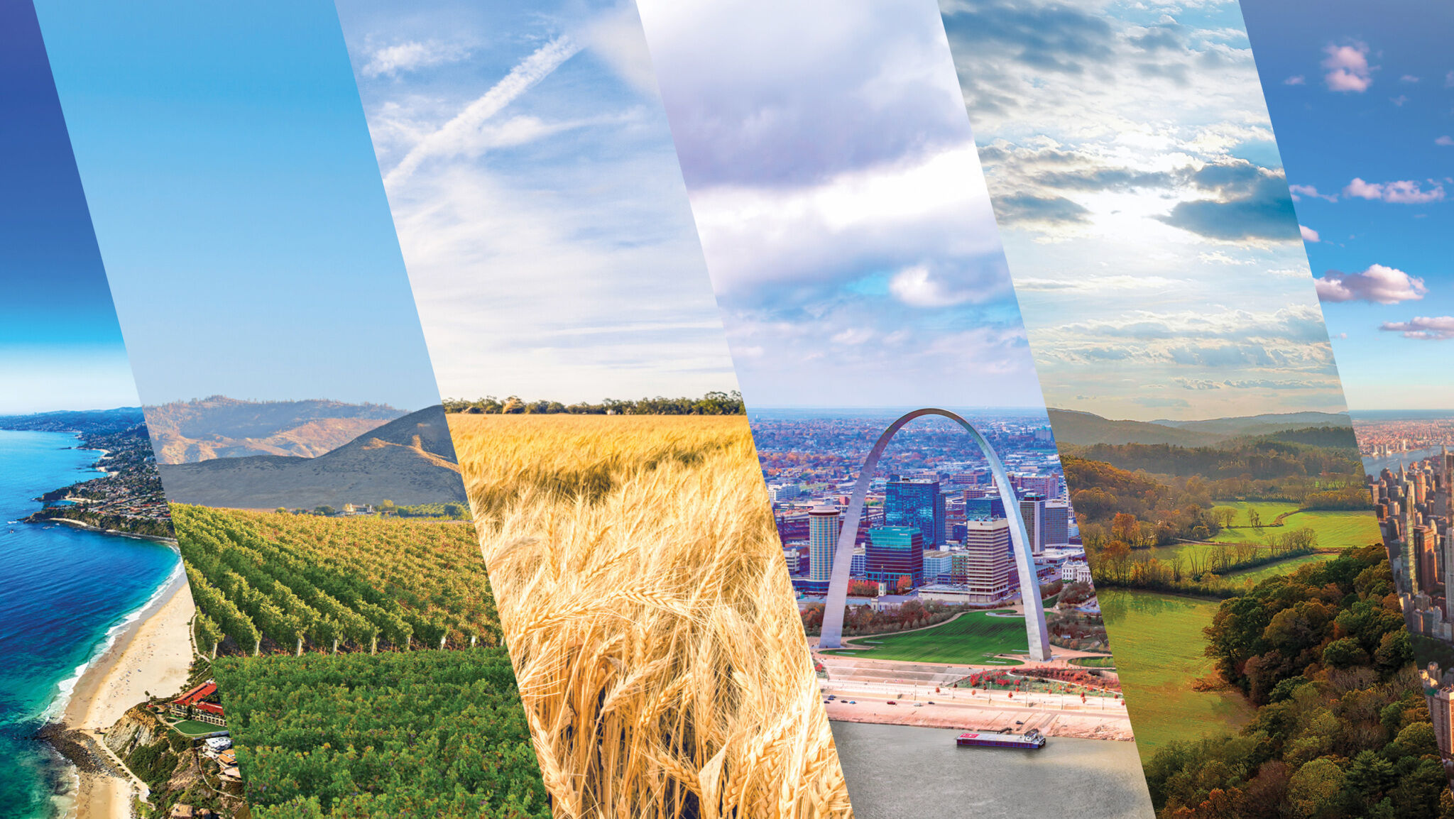
Mapping a Superpower

America is an exceptional country. The first solo trans-Atlantic flight, the first man on the moon, the construction of the Hoover Dam and Panama Canal, the defeat of the World War ii Axis powers, the national eradication of polio and the invention of gps all testify of American mettle and ingenuity. The people of the United States make up about 4 percent of the world’s population, yet they produce 26 percent of global economic output and hold 33 percent of the world’s wealth. Americans also enjoy one of the highest standards of living in the world, by far the highest for a populous nation. A handful of small countries like Luxembourg and Qatar have higher gross domestic products per capita, but they have just a fraction of 1 percent of the world’s population. America simply has an incomparable economic output.
The U.S. consistently ranks among or at the top of the world’s most creative, innovative countries. It is the most generous nation on the globe, and the most potent in cultural power. America has the highest degree of technological innovation of any country, and it has shone as a beacon of freedom for 250 years this month.
Despite its deep-rooted and worsening problems, the United States remains an unmatched engine of prosperity, generating extraordinary levels of wealth and opportunity. Commentators have long explained this exceptionalism through factors like laissez-faire economics, political institutions, cultural values, social mobility, freedom of speech and religion, and a broad commitment to equality. All of these matter. But there is another, often overlooked explanation—one that underpins many of the others. It is a foundation that reaches back into the earliest chapters of human history and quietly shapes everything built upon it: America’s geography.
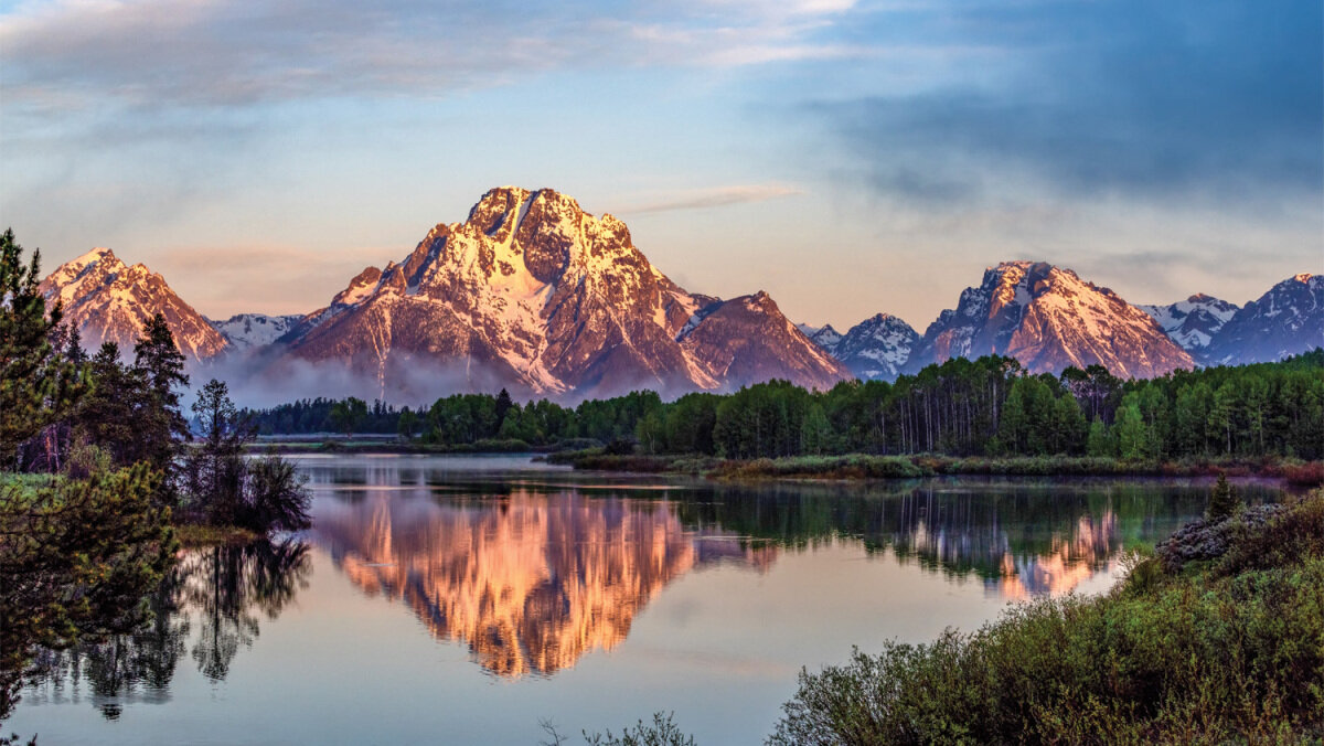
Land of the Temperate
Abraham Lincoln understood the exceptional geographic circumstances the American people had been placed in. He said, “We find ourselves in the peaceful possession of the fairest portion of the Earth, as regards extent of territory, fertility of soil and salubrity of climate.”
His emphasis on climate was astute because America’s most valuable geographic characteristic is not its immense amount of land but its immense amount of usable land.
Russia, Canada and China all have far more square mileage, but harsh climates render the bulk of their territory unusable for habitation, agriculture or development. Various austere climates also overshadow Australia and most nations of the Middle East, North Africa, Latin America and Asia.
In the United States, precipitation and temperature interact in rare harmony to yield the most resilient soils in the world. America has the largest contiguous mass of arable land on the globe, and this landmass is bookended by huge tracts of fertile terrain on both coasts.
These climatic conditions make possible an astonishing agricultural output: America’s 4 percent of the global population produces 30 percent of the world’s corn, 32 percent of soybeans, 40 percent of sorghum and similarly outsized proportions of numerous other agricultural commodities. Thanks overwhelmingly to the nation’s geography, the U.S. exports more food than any other country—and agriculture accounts for only 1 percent of its economy.
Beyond agriculture, the U.S. is richly endowed with mineral and energy resources. It is the world’s largest producer of crude oil and natural gas and a major exporter of both.
A River on Every Page
While most countries’ terrain is pleasantly interrupted by at least a few rivers, no other nation’s maritime transport system is as magnificent as that of the United States. AmericanRivers.org says the U.S. has over 250,000 rivers, totaling over 3.5 million miles of flowing water! A person could fly to the moon and back seven times and still not have traveled that many miles.
Even more valuable than the number of rivers is the fact that most of them connect to at least one other river, creating vast networks of waterways. Chief among these is the Mississippi River’s connection to the Ohio, Red, Tennessee and Missouri rivers, forming the largest interconnected network of navigable rivers on the planet.
Besides this incomparable internal transport system, the U.S. is also home to arguably all three of the world’s largest and best natural harbors: San Francisco Bay, Chesapeake Bay and New York Bay. It has dozens of other excellent natural harbors, too. The rivers connect to the ocean harbors and, from there, massive amounts of crops and goods can be inexpensively shipped around the globe. Meanwhile, U.S. coastal shipping is shielded in an extraordinary way by the series of barrier islands off the East Coast and the Gulf of Mexico. These island groups form intracoastal waterways that protect smaller watercraft and port facilities from all but the most tempestuous weather.
The value of America’s maritime network can best be understood by comparing it to that of other nations. Russia, for example, has several long rivers, but they seldom connect to each other, and not one leads to a convenient port. All three of Russia’s largest rivers flow obstinately north, emptying into the arctic sludge of the Arctic Ocean, and because they are frozen for most of the year, they are not navigable. The south-flowing Volga River drains into the Caspian Sea, but the Caspian is landlocked, so it can only transport Russian vodka and other goods to a few Middle Eastern and Central Asian countries. The Volga and the Caspian also freeze over for several months of each year, paralyzing these shipment lines. Before seizing Crimea in 2014, Russia had zero warm water ports.
As bad off as Russia is, many nations are in even poorer maritime transport situations.
America’s exceptional waterway system is truly miles beyond that of any other country, by no virtue of the American people. Recognition of this incredible blessing prompted journalist Charles Kuralt to famously write, “America is a great story and there is a river on every page.”
Turkey and Stuffing
Far more astonishing than America’s superlative agricultural capacity or its awe-inspiring natural maritime system is the way the two go together.
Rather than cutting arbitrarily through the country, dozens of America’s largest rivers intersect the nation’s agricultural zones with nearly perfect proportion and precision. Even without digging canals, boats can travel to almost any region of the Midwest from almost any region along the East or Gulf coasts. Agricultural products that aren’t needed locally can easily be floated down a river to a harbor, then moved to other parts of the nation or exported overseas.
Ordinarily, agricultural zones as vast as the American Midwest are underutilized because the expense of transporting their yield elsewhere slashes into the economics of cultivation. To return to the Russia comparison, even in modern times, Russian crops are liable to spoil before crossing the Eurasian Steppe to reach market. Russia must maintain colossal man-made transportation networks for its land to reach its potential.
But in the Greater Mississippi Basin, the bulk of agricultural turf lies within 120 miles of a navigable river.
The economic implications cannot be overstated. The geography of most nations requires their governments to scrape together heaps of capital to lay endless rail and asphalt—just to form transport capacity, the groundwork of an economy. But geography provided America with an almost flawless system at no expense. America’s intrinsic transport capacity freed the nation’s resources for other economic pursuits and virtually guaranteed that America would be capital-rich.
With the available capital, America was able to complete its first transcontinental railroad in 1869 and its first coast-to-coast roadway in 1913. Russia completed its first transcontinental railroad in 1916, and its first cross-country highway in 2008!
America’s agricultural capacity and its maritime system are the turkey and stuffing of its geography: They go together perfectly.
A Tenable Tower
For most countries, the risk of invasion remains a serious strategic concern. Russia must account for security threats along multiple borders, including historical adversaries such as Germany and powers like China and Poland. France lives with the possibility of renewed conflict with Germany or the United Kingdom. In East Asia, China’s strategic environment includes Japan and Russia, while India must be on guard against both Pakistan and China. Pakistan faces pressures from India and Iran. In the Middle East, Iran’s strategic calculations include Saudi Arabia, Israel and Turkey, while Saudi Arabia and Israel operate within a broader regional power struggle involving Iran, Turkey and Egypt.
But because of geography, the situation for the U.S. is entirely different.
To the east and west, the nation is buffered from other countries by thousands of miles of shining sea.
To the south lies Mexico, with terrain mostly too mountainous, too tropical or too arid for anything but subsistence agriculture. Mexico also has no significant maritime transport system and is largely separated from the U.S. by a desert border. For much of recent history, Mexico has presented no significant threat to the United States. (This is beginning to change due to the aggressive incursion of increasingly powerful drug cartels and the increasing power of terrorism and asymmetrical warfare.)
Canada to the north is far more mountainous and far colder than America. Canada’s only traversable waterway system, the St. Lawrence Seaway and Great Lakes, belongs as much to the U.S. as to Canada. Additionally, the bulk of Canada’s arable land lies just along the American border, making it economically wiser for its provinces to integrate with the states for exporting than to work with its neighboring provinces.
So while geography hinders Mexico and Canada, it empowers the United States, leaving it with no major continental competition. The result is that the U.S. does not need to maintain a large standing military presence on any of its borders. And if a threat does flare up, the U.S. transport network allows it to quickly deploy its forces.
Chance or Design?
So exceptional is America’s geographic situation that Stratfor calls the United States “the inevitable empire.” When considering the combination of “the robust natural transport network overlaying vast tracts of excellent farmland, sharing a continent with two much smaller and weaker powers—it is inevitable that whoever controls the middle third of North America will be a great power” (Aug. 24, 2011).
If the people who inhabit this exceptional real estate were geographically guaranteed to become great, then it’s worth considering how the American people came to possess it.
The Bible makes clear that God, and not men, determined the geographic locations and national borders of the Earth’s various peoples. The Apostle Paul explained in Acts 17:26 that God “hath made of one blood all nations of men for to dwell on all the face of the earth, and hath determined the times before appointed, and the bounds of their habitation” (see also Deuteronomy 32:8; 2 Samuel 7:10).
Long before Paul explained that truth, God inspired the Old Testament patriarch Jacob to bestow a landmark blessing upon his two grandsons Ephraim and Manasseh. He placed his left hand on the head of Manasseh, the older of the two boys, and blessed him, saying he would become a great single nation (Genesis 48:14-20; 49:22-24). God fulfilled this promise to Manasseh spectacularly in the 19th and 20th centuries, when the United States of America attained towering cultural dominance, unparalleled military might and mind-boggling economic power.
But before the 20th century, before the 19th century, and long before Ephraim and Manasseh were born, the Creator foreordained America’s greatness with geography.
All the way back when He was re-creating the Earth as recorded in Genesis 1—sculpting its surface, separating dry land from sea, and carving out the continents—God was mindful of Manasseh and of His future promise to make of him the single greatest nation on Earth. Toward this end, God designated a massive and exceptional chunk of real estate for Manasseh’s descendants, the American people.
Geography also motivates the U.S. government to take a more hands-off economic approach not found in any other nation. Laissez-faire capitalism has flaws, but it has contributed to America becoming a bastion of freedom. A deeper look into America’s geography reveals that God set Manasseh in a position where economic and religious freedom would reign and His end-time work could be carried out, free of the persecution that would have plagued it in most any other nation.
How inspiring to consider that the Creator set apart the bulk of American land for some 5,500 years of mankind’s history, keeping it relatively isolated and thinly populated until Manasseh was ready to inhabit it and receive these astounding blessings 250 years ago! God “determined the bound” of U.S. borders, and He used geography mightily to foreordain America’s power and prosperity!


